
Area of influence Map of Idlib and its surroundings
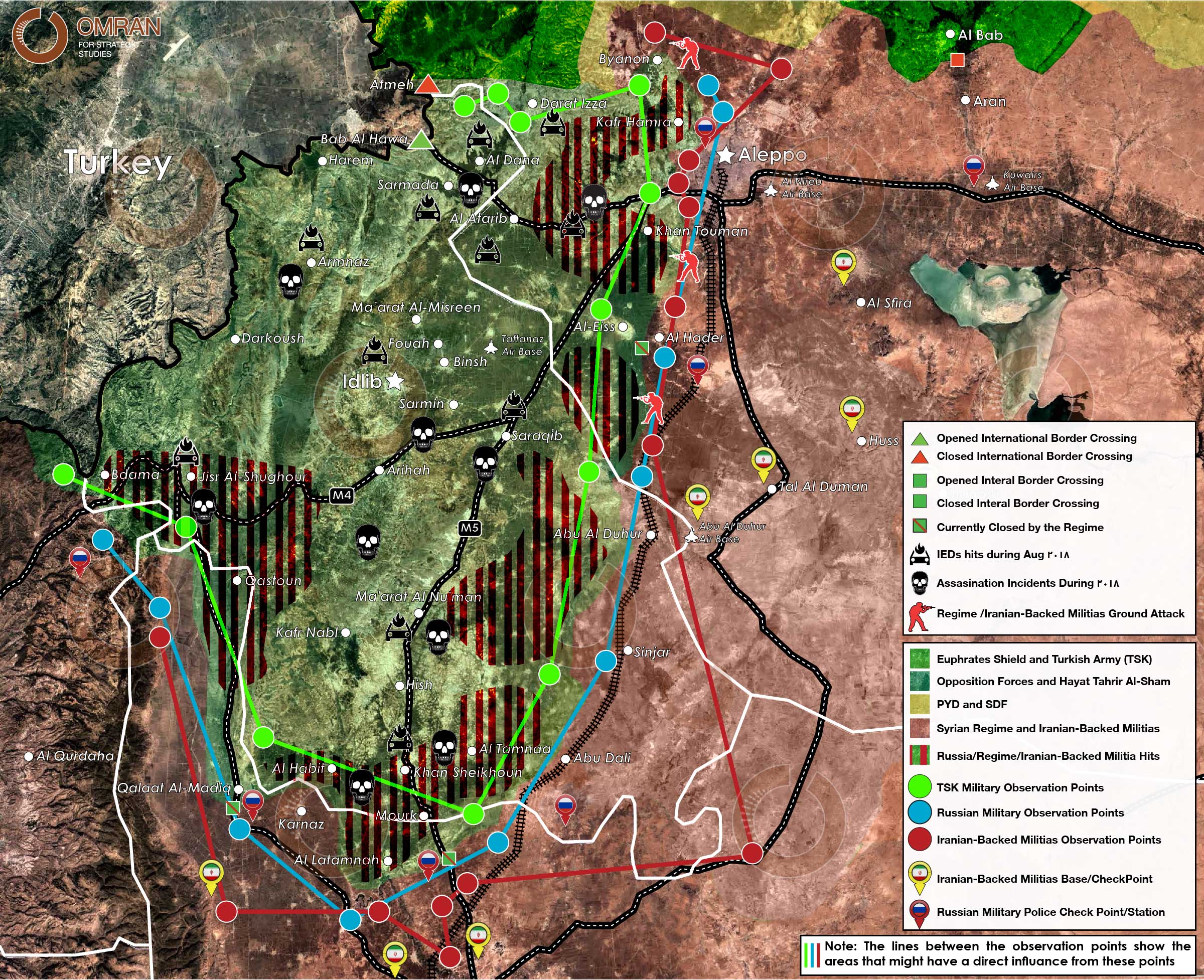
Map 1: Updated situation map of Idlib, western Aleppo and northern Hama
- Iranian-backed militias’ military bases.
- Russian military police checkpoints around Idlib province.
- International Highways crossing Idlib province (M4 and M5).
- International border crossings with their current operating status and internal border crossings with their current operating status.
- Areas targeted by regime forces, Russian air force, and Iranian-backed militias’ artillery in August 2018.
- Sites of IEDs and assassination incidents that occurred in Idlib and western Aleppo Province in August 2018.
Notes:
- M4 and M5 highways are considered one of the main strategic targets for any possible attacks from the Regime and his Iranian allies.
- Internal border crossings are trading hubs between areas under regime control and areas under opposition control. Currently these borders are closed by the regime for different reasons, except "Qalat Al-Madiq" in Sahel Al-Ghab was partially opened in the last few days to allow the last IDPs convoy from the south to enter Idlib.
- On 13 August, Russian Military Police took over both "Qalat Al-Madiq and Mourek" corresponding internal border crossing sites in regime areas replacing the Syrian Army’s 4th Division (Affiliated with Iran).