Omran News
Special Areas of Control and Influence Report June 2018
Updated Influence report and map of Syria 22 June 2018 with % of Gains & Losses in the last 34 Days. Ongoing battles on the Northeast front of Daraa, Regime and allies forces with Russian air support of are trying to control the area to the east of Damascus - Daraa international highway to Nasib crossing gate.
Meanwhile YPG with US support launched a new Military Campaign against ISIS in Southern Hassaka.
Updated Map: Areas of Influence and Control
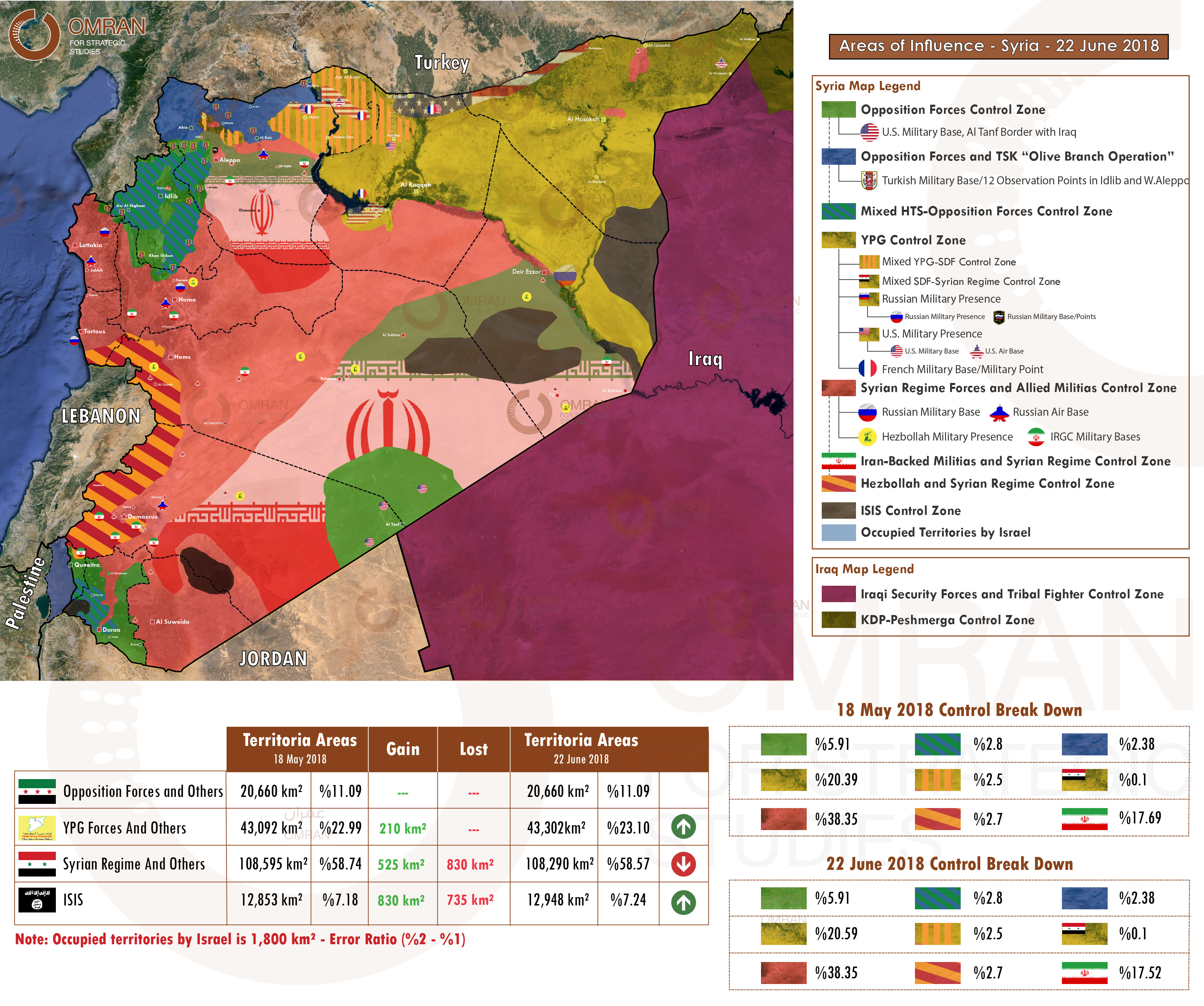
Map (1): Areas of Influence - Syria - 22 June 2018
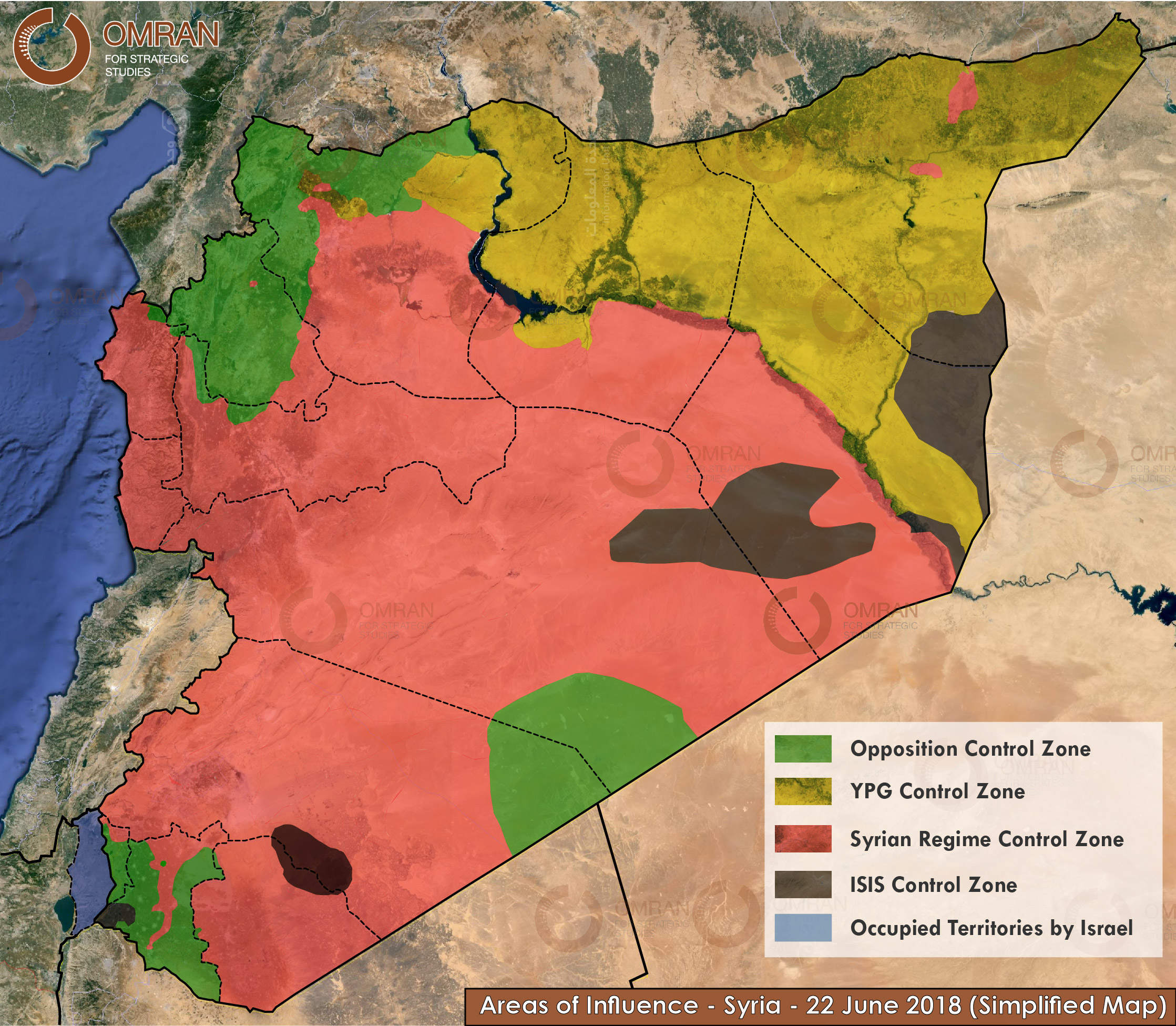
Map (2): Areas of Influence - Syria - 22 June 2018 (Simplified Map)
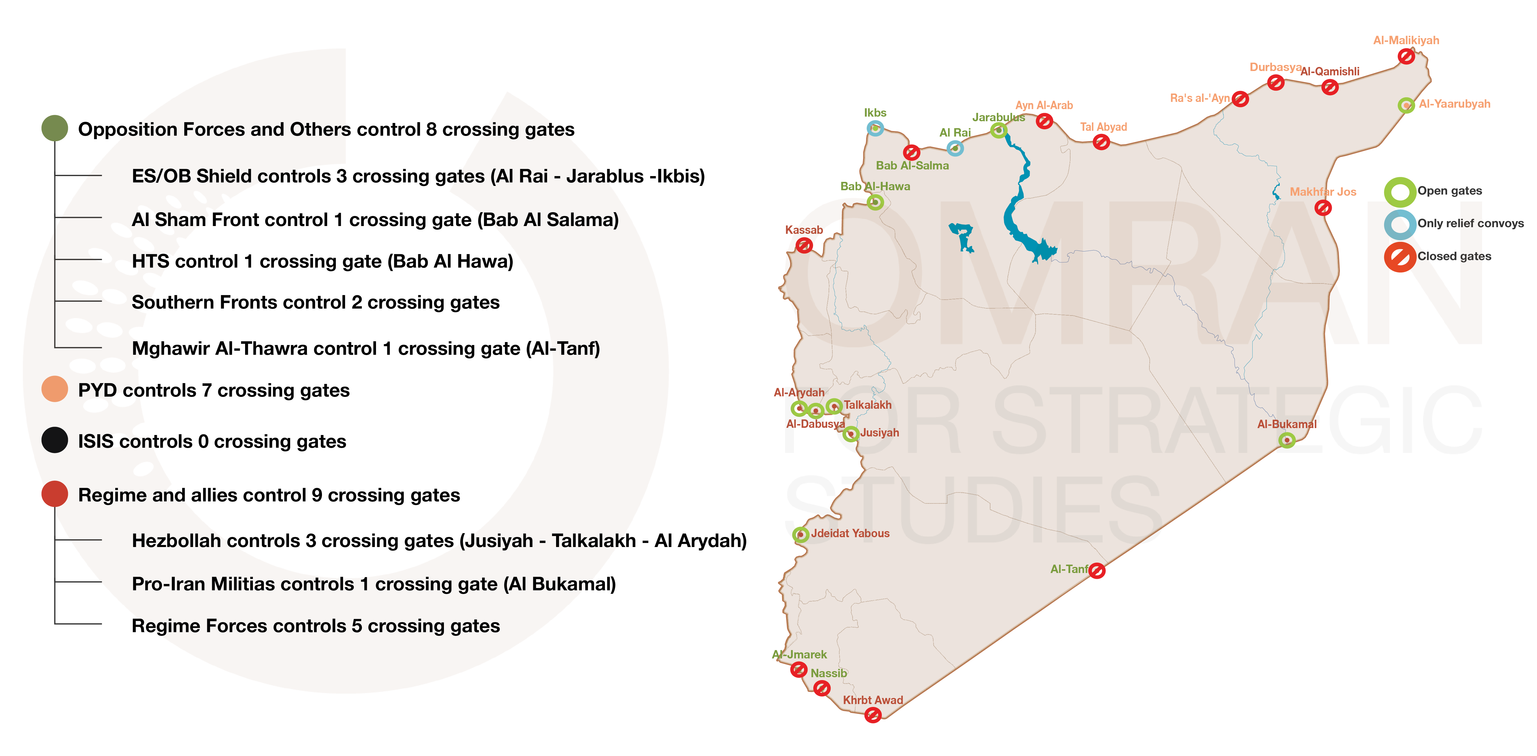
Map (3): Crossing Gate Control Breakdown and Current Situation
Percentage of Control Breakdown
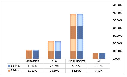
Chart (1): Simplified Percentage of Control (May vs. June) 2018
Note: The charts below show the percentage of total Syrian territory that each faction controls.
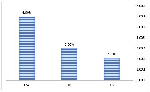
Chart (2): Percentage of Syrian Territory Controlled by Opposition Groups
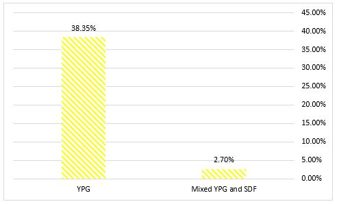
Chart (3): Percentage of Syrian Territory controlled by the YPG
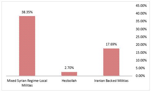
Chart (3): Percentage of Syrian Regime and Allies Control Areas Breakdown
Presence of International Forces
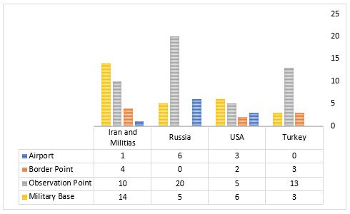
Chart (4): Main International Military Bases and Airports – June 2018